
Traveling from the Trout Creek Bridge, we are headed west towards the town of Meyer’s. Along the way, our Lincoln Highway map has a small truck icon along the road. Clicking the icon, we find that this was the route used in 1919 by the US Army convoy traveling from Washington DC to San Francisco.

Click map for closer view!
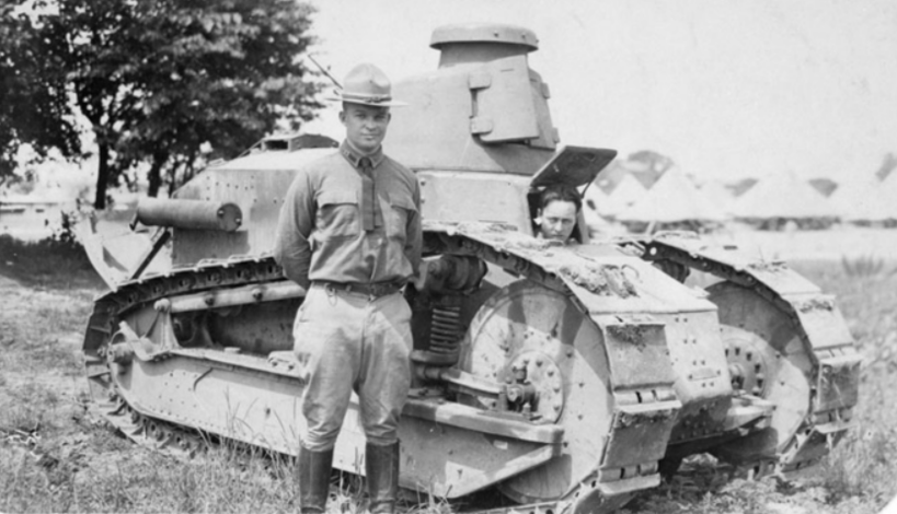
This convoy was an attempt by the US Army to see if it could transport men and machines across the country on the new Transcontinental Lincoln HIghway. In 1919 it was still a novelty to drive across the country, and while the convoy made it, the trip was fraught with breakdowns, poor bridge crossing, deep mud, and sand. Along for the trip was Armored Corps representative, Lt. Col. Dwight D. Eisenhower, a 28-year-old officer, and future President of the United States.
Lt. Col. Dwight D. Eisenhower. Photo: National Archives
There is a video record of some of the trip at the National Archives', which can be found here. When the convoy reached Meyer’s, the pioneering Celio Family, who owned much of the small town, threw a huge celebration and BBQ for the soldiers. The convoy then made the trip up Osgood’s Grade and over Johnson’s Pass.
Looking at the map above, we can see the old Osgood’s/Meyer’s Grade up to Echo Summit is closed through traffic. It’s now a popular and very steep trail on a paved surface., where we see Monica making the climb in the photo below. This was the grade everyone used to get to the south Tahoe area for 80 years, until the 1930s when the present freeway was built.

Auto’s leaked fluids much more in days’ gone by. You can see the oil streak on the road. The Celio Ranch is marked with an arrow. This is their ranch along South Upper Truckee Road. Click the photo for a closer view.
The photo above was taken by TC Wohlbrück and showed the grade looking east. This is the same section we see Monica walking on in the photo below. TC Wohlbrück was an entrepreneur who built some of the first gasoline service stations and “rest stops” in the Sierra, which he called Canteens. He built one at the top of this grade, Johnson’s Pass, and it still stands today. You can read more about TC here. We will talk about that on our next post along the El Dorado County Lincoln Highway route.

Monica walking up Osgood’s Grade, now closed to traffic.