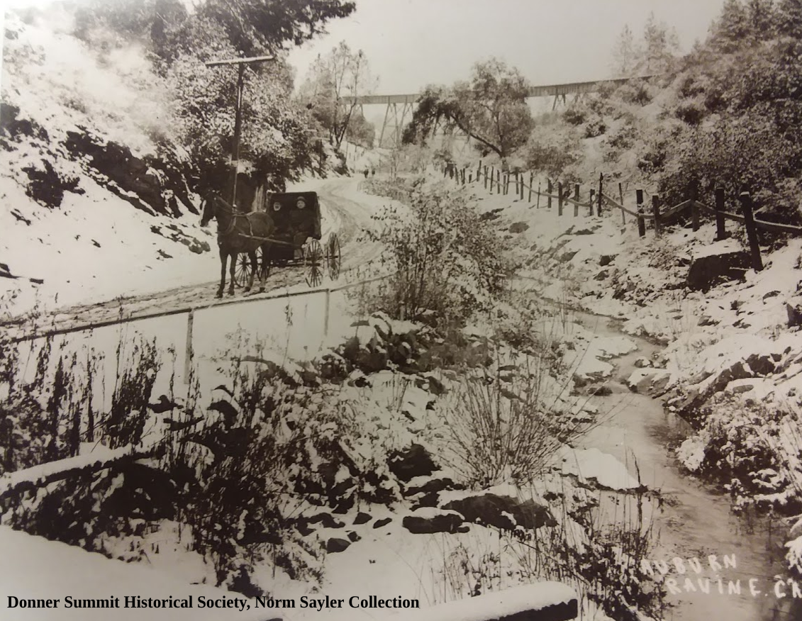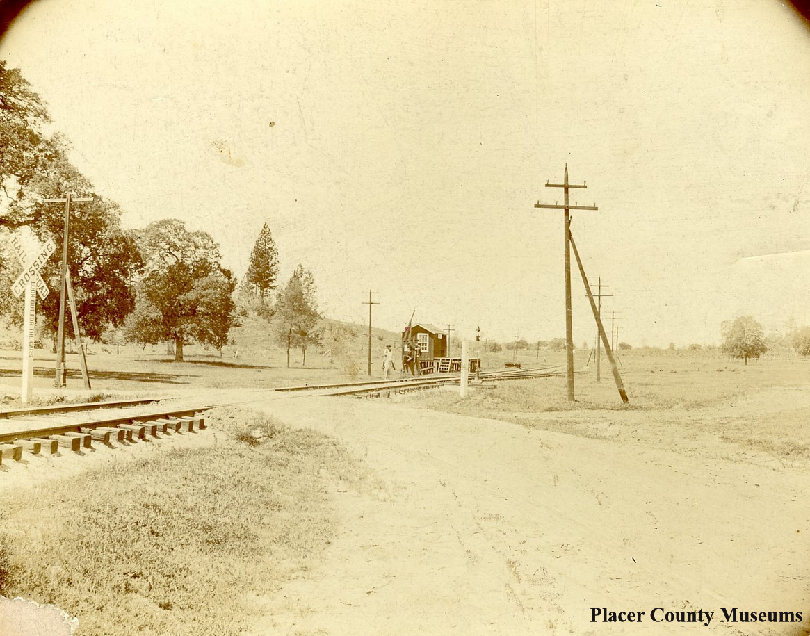
The photo above, taken in the 1900s, shows the Bowman Crossing of the Southern Pacific Railroad. If you look closely, there is a person on a horse and another standing nearby. What caught my attention was the way the road makes a bend towards the photographer. If we head the other way, we will pass Machado’s Orchard on our way to Auburn once we cross the tracks. It was this photo that caused us to stop and check out this famous crossing again. We wanted to make sure our official Lincoln Highway map had the routes across the tracks marked correctly. We’ve checked out this area before but were unable to spot the old road. Recently someone has cleared out the area making it more open and visible.
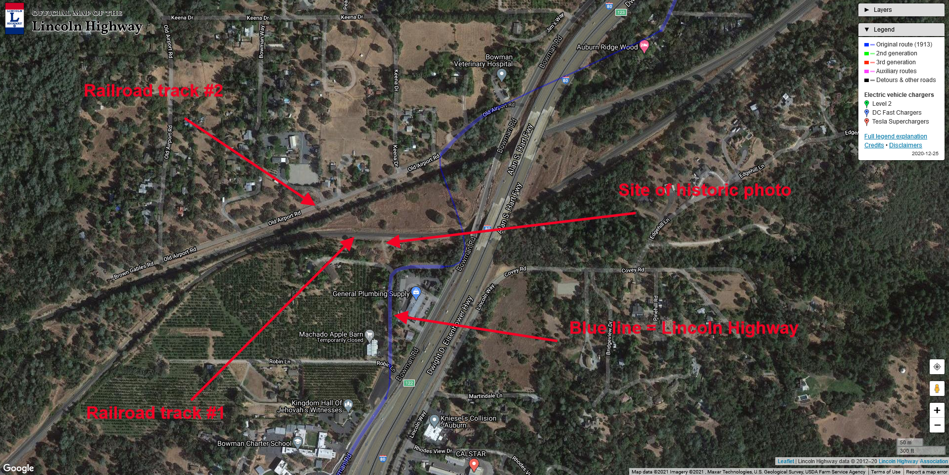
The map at right will show the general area and some of the features discussed. We can see the two rail lines, the Lincoln Highway's blue line, and the crossing pictured in the historic photograph. East is to the right, west to the left. Notice how the crossing in the historic photo is actually west of our Lincoln Highway map shows the crossing. Click map for a larger view.

The same spot as the historic photo, but today. You can see our truck at the left.
In the photo below, we have moved east and can now see the road's impression at right. It appears that once you crossed the first rail line, you would take a hard right and head east. You can see Monica in the background on the road. Our truck is on the other side of the tracks at the crossing.

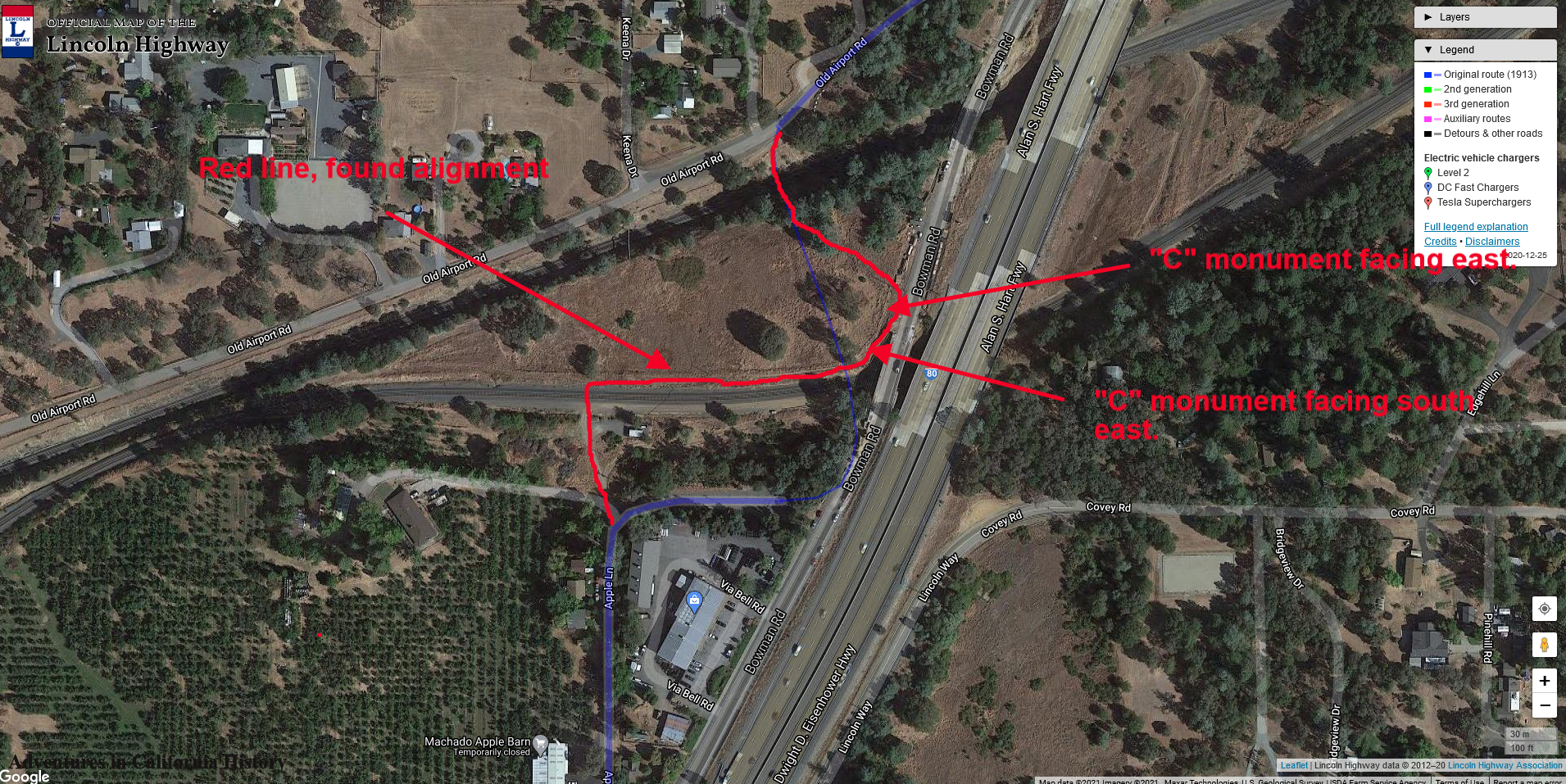
While the impression we were following could be the road, it would be nice to find some more evidence that this was indeed the transcontinental highway's route. We found the evidence because of the recent clearing of trees and shrubs in this area. We found a state “C” monument facing east and another just a few yards away. These markers were placed along state routes from 1914 to the 1930s. Finding these markers is a great affirmation you are on the right track.

Here we see Monica by the “C” monument. The taller metal sign has the letters R/W on it, which means “right of way.” Placer County has put these metal markers at the site of these older stone monuments. This makes finding the old monuments much easier in this county than others who don’t mark these. We found another marker just a few yards from this one, giving us the road's general route. See the map below for more detail.

Covey Rd., which we originally had our route marked on, is actually a road that crosses over Highway 80. We do not believe the Lincoln Highway route crossed where we had originally marked it. Below we have marked where we believe the route actually crossed the first tracks and then made its way towards crossing the second set of tracks. There a long-gone bridge crossed the second set of rail tracks.
Click map for a larger view.
To summarize, the Lincoln Highway crossed the first set of tracks at a different place than we had earlier thought. After crossing the first set of tracks, the road makes an immediate right, following alongside the rail line, just before where the present Bowman Road is, a sharp left, then another left to head towards crossing the long-gone bridge over the second set of tracks.
These changes to the route are sent to the Lincoln Highway Associations’ cartographer. If they agree with our findings, we will change the official map to show the newly found route.