Monica and I had wanted to visit the site of the old Brockliss Bridge for some time. We would pass by the crumbling buildings of Pacific House on Highway 50, and then the old Peavine Ridge Road down to the river would beckon.
Pacific House was a stop for weary travelers along Johnson’s Cut-Off Trail and later the county Placerville to Lake Tahoe Road, Lincoln Highway, and Highway 50.
Leaving Pacific House and heading down Peavine Ridge Road, we came upon this magnificent block wall, pictured above, which seemed to have been built for the later roads that follow the Highway 50 route. This wall extends for a couple of hundred yards. The rock work seems to be the same type and era of other rock work we have seen along the county road's older sections. Likely this was built in the late 19th or early 20th Century.

Brockliss-Blair Bridge foundations. This was the third and last bridge located at this spot.
It’s a steep grade down to the bridge site, and we imagined the countless teams of hoses and wagons that once climbed up this very hill on their way to the goldfields. When the 1859 Silver boomed commenced in Nevada, the traffic reversed course and headed down the grade as we are.

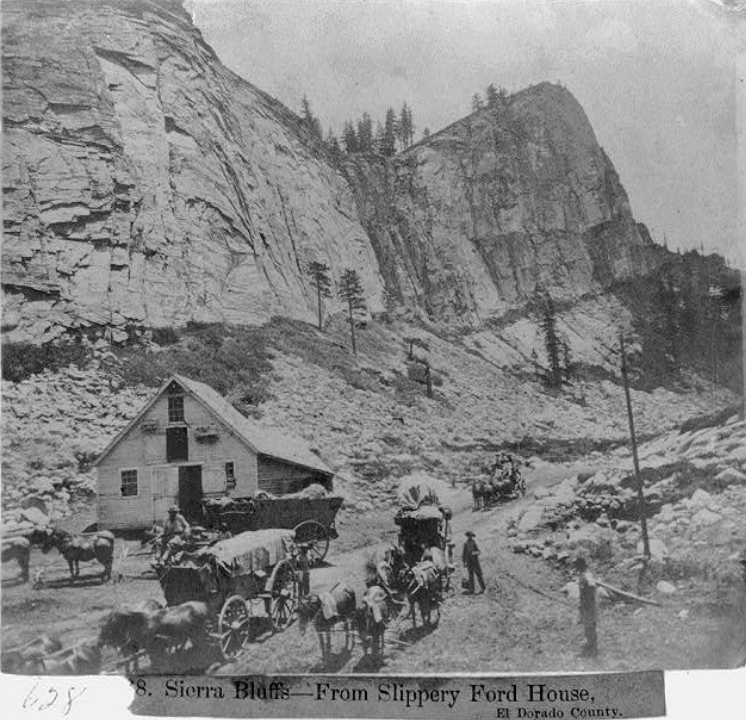
Here is a beautiful rendering of the old Brockliss Bridge and toll station during the heydays of its existence. It looks like this was looking west, from the south side of the river.
This spot along the river was a natural ford (crossing) of John C. “Cockeye” Johnson’s overland trail. In 1853, he built a bridge, but winter floods the following year washed it away. With all the traffic, it was becoming apparent that this spot needed a new bridge.
The state legislature funded a timber lock arch structure in 1855-56, built by Anthony Brockliss, at the cost of $11,300. That bridge, after considerable use, collapsed in 1869. No bridge crossed this spot for the next 60 years.
In 1929 the Blair Brother Lumber Company built a third bridge at the site, known as the Brockliss-Blair Bridge. Lumber trucks and others used this bridge until the Forest Service destroyed it after 60 years of service. The concrete foundations at each side of the river are from this last bridge. We could find no evidence of the earlier bridges.

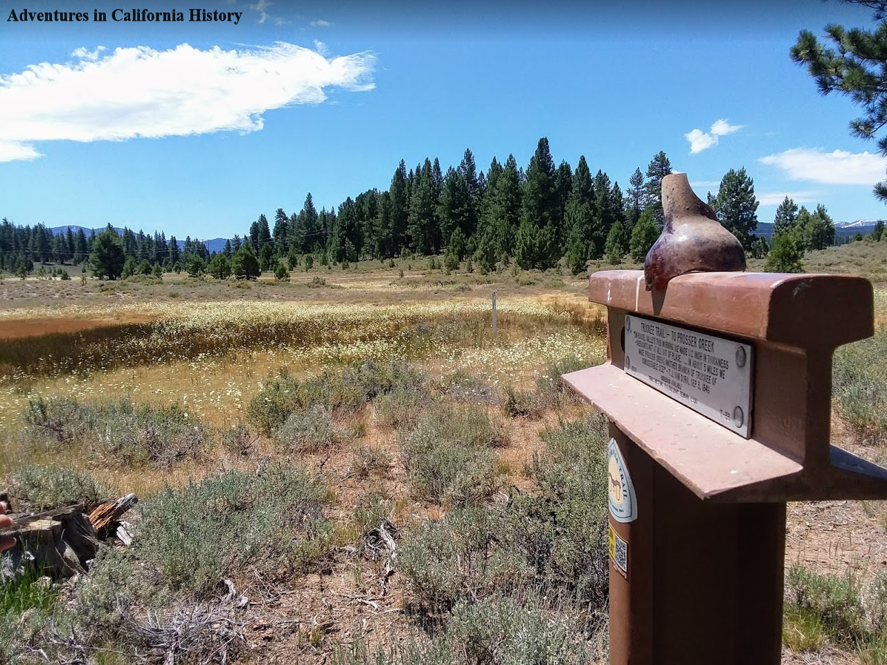
Trails West “T” Marker at the bottom of the grade at Pacific House.
At the bottom of the grade, the Trails West group has installed one of their "T" markers with a pioneer's quote. John McTurk commented in 1859 on the fare, $1, and the steep climb up after crossing the bridge. Still a steep climb up!
It’s always enjoyable to walk these old trails and imagine what it was like in the “old days.” This road would have had so much traffic during its early existence that if you left the line, you might not be able to proceed until nightfall. Amazing! Today, other than in summer, when people head down to the swimming hole, you are likely the only people on this trail. It’s history, almost all but forgotten.

A map of the area and features. Click the map to make it larger.